Know which buildings need the search teams first.
Building Damage Classification grades the structures in the affected area from vertical very-high-resolution imagery and sorts the list by triage priority, so the first teams go where the damage is worst.
- GSD
- ≤0.5 m (VHR)
- Cadence
- Event driven
- Platform
- VHR satellite / aerial
- Spectral
- RGB
How the first operational period gets sequenced
The ground shakes, the EOC opens, and the picture builds from what reaches the room. 911 calls come in. Patrol units and fire companies report from their sectors. Damage reporting teams head out to assigned areas and radio back what they pass. The coordinator pins it to a map and decides where the first search teams go.
The trouble is where the information comes from. Reports arrive from blocks where phones still work and someone is awake and able to call. A neighbourhood that lost power and cell service, or where the people who would call are under the roof, sends nothing. A quiet grid square looks like a fine one. Meanwhile the ground survey moves street by street, a team can only be in one place, and the safety evaluators with their ATC-20 placards come in after the search and work building by building.
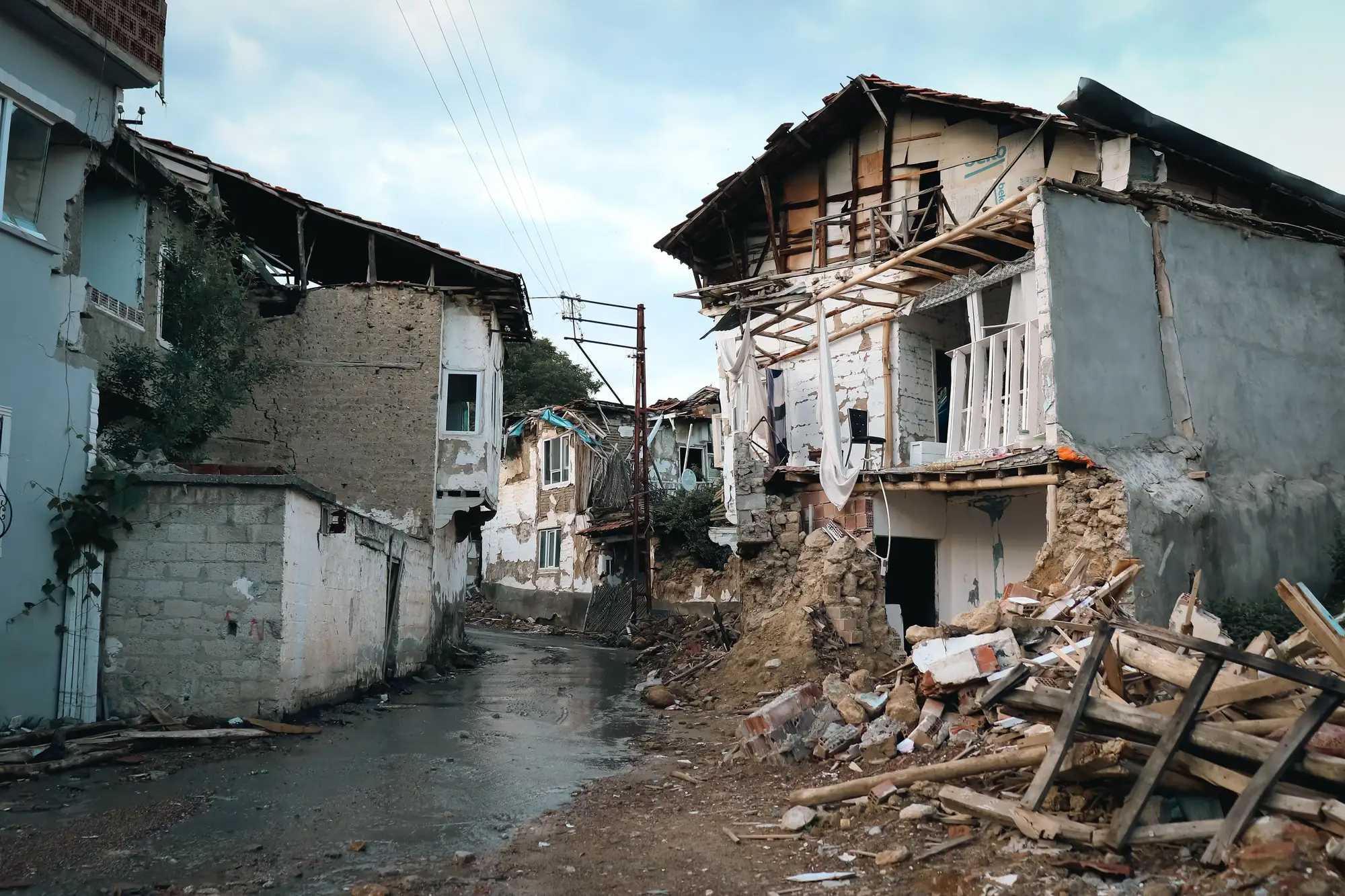
So teams get sent by volume of noise rather than by damage. Shelter planning has the same gap: nobody yet knows how many buildings a neighbourhood has lost, only which ones somebody happened to drive past.
An imagery pass over the whole affected area doesn't fix that by itself, and it won't find a person. It gives the coordinator a dated, structure-by-structure read of every block, sorted worst-first, to set beside the calls and the field reports.
What comes back
- 2.1
Structure-level damage grade
Every structure in the affected area gets a damage class and a date, from the post-event pass compared with the pre-event image. Structures the imagery can't grade with confidence are marked as such and listed, not given a guess. It arrives as a GIS layer that opens in ArcGIS or QGIS next to your own operating picture.
- 2.2
Before/after image pair
For each graded structure, the pre-event and post-event image chips side by side, so a team lead or a reviewer can see what the grade was based on before sending anyone.
- 2.3
Triage-priority sort
The same grades as a list ordered for response sequencing: worst first, with the grid reference you would hand a team. It is meant to sit on the planning section's wall next to the incident action plan.
- 2.4
GIS export
The layer and the sorted list as files you can bring into your own mapping and planning tools. As the response moves from search to recovery, the same grading gives a count of unusable buildings by area for shelter demand.
How it works
Area in
You define the affected area: a polygon, or a shake-map contour and the neighbourhoods inside it. We confirm coverage with you.
Imagery
We take a vertical VHR pass over that area as soon as a usable look is available, satellite or aerial. It has to be daylight and clear enough to see rooftops.
Analysis
Classification and change detection against the pre-event image grade each structure.
Delivery
You receive a dated, sorted damage-grade layer. We tell you the capture time of the imagery so you know what the grade reflects.
Where it fits in your workflow
Between the first calls and the first teams
Use the layer straight after the earthquake, ahead of ground teams' first deployments, to sequence which blocks get checked first and to spot the quiet grid squares nobody has phoned in. Field reports and calls still run the response; the grades add the blocks they didn't cover.
Once search gives way to recovery, the same grading feeds shelter-demand planning: which neighbourhoods have the most structures graded badly, and where the evaluators should go first for placards.
Limits
- L01
Vertical view only
Imagery looks down at roofs. Damage that lives on a facade, a floor that pancaked under an intact roof, or a leaning building can read as undamaged or come back as possibly damaged. Ground truth is still needed for those.
- L02
Half a metre a pixel
At ≤0.5 m a house is many pixels across, enough to see a roof gone or a footprint reduced to rubble. It is not enough to grade a cracked wall or a broken window, so moderate damage is the hardest class to call.
- L03
Daylight and clear sky
Optical imagery needs daylight. A night-time quake waits for the next daylight window. Cloud, smoke and dust over the area push the first usable pass later.
- L04
Timing follows the imagery
How soon the layer arrives depends on the first usable pass and on tasking. We don't promise a delivery time in advance.
- L05
Not an inspection
A grade is a triage read from imagery. It doesn't replace an ATC-20 evaluation or any inspection by a structural engineer, and it doesn't clear a building for entry or re-occupancy.
- L06
Structures, not people
It doesn't find survivors, count casualties or say where anyone is trapped. Search teams decide that on site.
Who it's for
For
- Emergency management coordinators and EOC operations or planning staff sequencing search teams after an earthquake
- USAR task force leaders and fire operations chiefs who need a sorted list of blocks
- Planners working out shelter demand as the response moves to recovery
Not for
- Structural safety evaluation or placarding of a building
- Locating survivors or estimating casualties
- Flood, fire, wind or other events; it is scoped to earthquake damage to buildings
- Areas where no usable daylight, cloud-free pass has been captured yet
Questions from the EOC
How fast after the quake is this available?
It follows the first usable, cloud-free vertical pass over your area, which depends on tasking and weather. We won't quote a fixed time before we know your area and the imagery available.
Does a grade replace a structural engineer's assessment?
No. It sets the order for search and inspection. Engineers and ATC-20 evaluators still decide whether a building is safe.
Does this find survivors?
No. It flags the structures most likely to be badly damaged so teams can prioritise. People are found by people.
What if the quake happens at night?
Optical imagery needs daylight, so the first pass is the next daylight window that is clear enough.
Can this cover a whole city?
You define the affected area and we confirm coverage with you before anything is ordered. Areas under cloud or smoke are called out, not graded blind.
How do we check the grades against what teams see?
Compare the layer with the first field reports and with evaluator postings as they come in, block by block. Ground-truth verification stays with your teams, and the before/after pairs let you see what a grade was based on.
Will it load into our GIS and shelter planning tools?
It comes as GIS files plus a sorted list, so anything that reads a map layer or a spreadsheet can take it. We don't write into your systems directly.
Who owns the imagery and the results?
Ownership and licence terms are written into the agreement before anything is ordered. If your county counsel needs to review them, ask early.
How is it bought and priced?
Pricing depends on the size of the affected area and the imagery source, and is scoped with you. Terms can be discussed before an event.
Talk to us before the ground moves.
Tell us your county or city's area of responsibility and how your EOC takes in imagery. We will tell you plainly what a response would look like and what we can't promise.
Get started